From Untamed Riverbank to Beloved City Landmark: The History of Designing Modern-Day Falls Park
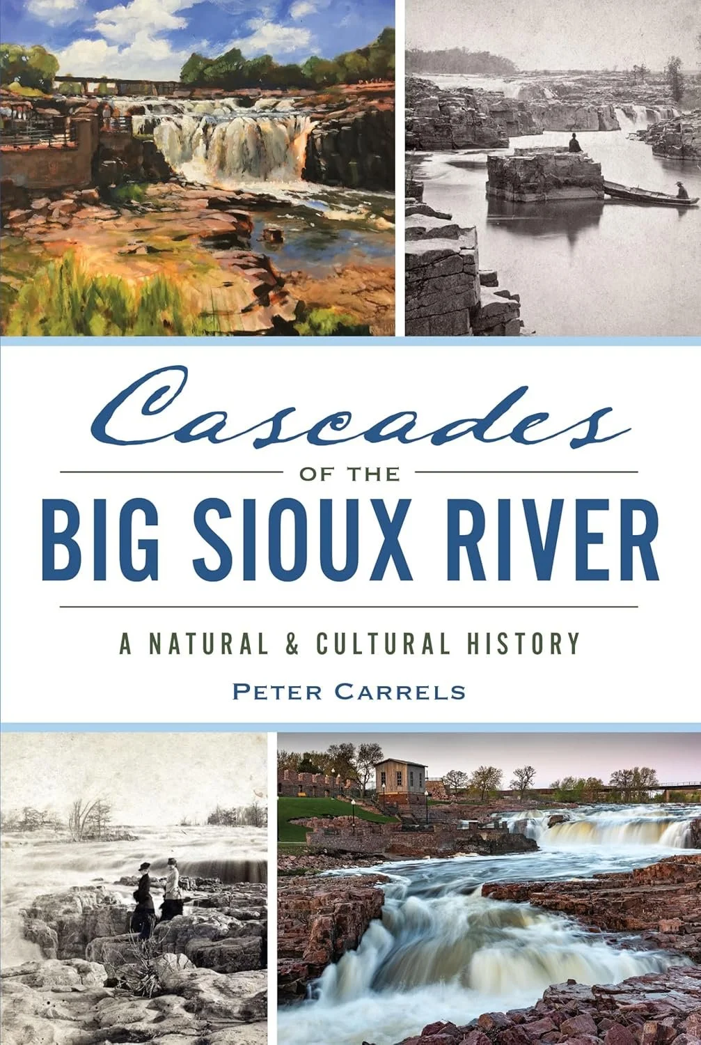
Presented here is an excerpt from Peter Carrels’s book titled Cascades of the Big Sioux River. This book, published by the History Press, provides a natural and cultural history of the falls in Sioux Falls. The book is currently available for purchase online and in local bookstores.
In 1991, Sioux Falls mayor Jack White, city planning director Steve Metli and Metli’s assistant Mike Cooper decided that a comprehensive master plan for Falls Park, prepared by professional landscape architects, was overdue. Until then, city officials had mostly implemented their own ideas for the modest park improvements that had been undertaken. To pursue more dramatic and meaningful park upgrades, the city hired Big Muddy Workshop, a firm based in Omaha, Nebraska. Cooper, who would eventually manage both the city’s planning office and the parks and recreation department during his public service career, would be the city’s project manager working directly with Big Muddy.
The owner and leader of Big Muddy was John Royster, a landscape architect who grew up in Canistota, South Dakota, thirty miles from Sioux Falls. Royster’s feelings for the falls were rooted in his childhood, when he and his family drove from their home to picnic at the park. As an expert in designing and directing development of outdoor spaces and parks, Royster brought a thoughtful and sensitive creativity to his work, explaining that his intention was to “celebrate and conserve a landscape.” Big Muddy Workshop, he said, specialized in “environmentally responsible designs that encouraged people to encounter natural landscapes so they can form positive relationships with the land.” Both locals and out-of-towners were drawn to the place, Royster realized, to savor the sensational scenery, but he felt there was more to experience.
Royster began to study the park’s natural conditions and the buildings and roadways surrounding the park. It was apparent that the park remained oriented to visitors viewing the falls from their cars or trucks. “Our objective was to get people out of their cars,” said Royster. “We wanted people to become pedestrians at the park and view the falls in ways they’d never seen.” Mike Cooper remembered citizen resistance when it was announced that walking, rather than riding, would be the park’s new emphasis. “It was,” acknowledged Cooper, “a big change, but it needed to happen.” Royster’s wife, Katie Blesener, vice president of Big Muddy, explained that their plan was to connect visitors to nature. “We wanted people to have an authentic rather than a commercial experience,” she said.
On a summer afternoon in 2024, John and Katie stood together in the shade of an oak tree at Falls Park, describing the urban nature sanctuary they helped design. A massive rainstorm had rumbled through the area earlier in the week, and the falls were roaring. A steady parade of visitors strolled past, and all eyes were trained on the stunning spectacle. The more adventurous wandered about on walkable quartzite outcrops nearer the raging river. Phones held to faces were common as photos and videos of falling water were captured. A man from Alabama snapped a few photos and said, simply, “Never expected to see this here.” “It is gratifying,” John Royster declared, “to witness so many people admiring this special place.”
Three decades after Big Muddy and Sioux Falls transformed a raw park brimming with potential into an inspiring and appealing destination, Royster pointed out the physical elements incorporated into the master plan. The multiyear process began with the basics. “When we first examined the park property,” recalled Royster, “it was overgrown with invasive species, and weeds and bushes sprouted from gaps in the quartzite along the river. All that needed to go.” There was patchy grass and trees that needed tending. Some trees were removed, and new trees were planted. Purposeful landscaping was applied. The perimeter of the park, affecting the ambiance of the park’s interior, had been improved by removing industrial enterprises, but more relocations needed to happen. Homeless people continued to build makeshift shelters in the park’s thickets and woods, a fact that saddened Royster. But he knew that situation must change.
Parking lots crowding the river were bulldozed and replaced by better built versions set back from the falls. Roadways winding toward those parking lots encouraged slow travel. New sidewalks offered breathtaking vistas and led visitors to appealing viewing platforms along the river. Visible quartzite formations situated throughout the park were integrated into the park’s features as environmental highlights. Overhead power lines were buried. Historically themed streetlights were added alongside roadways and walkways. The city’s horse barn, a curious relic from yesteryear located in the northeast corner of the park, which once served as a storage building for the city’s utility department, was remodeled and opened as an art center.
Details such as the color of concrete were considered. “Steve Metli came up with the idea of tinting some concrete sidewalks reddish to complement the quartzite,” Royster explained. Katie Blesener wrote content for new educational signage. To determine locations for six new concrete viewing platforms, Royster made numerous site visits and slowly walked and carefully studied the park, the cascades and the shoreline. He reviewed topographic surveys, paying special attention to rock formations offering advantageous views and solid footings to support construction. He considered factors such as height and orientation.
South of the railroad bridge, on the west side of the river, twin viewing platforms—one low, one higher—were constructed to offer different views of the uppermost stretch of the river’s cascades, a broad, shallow channel with lots of visible, low-slung quartzite. In this stretch of river, high flows don’t rumble; they riffle over sheets of smooth rock. This is where the cascades commence, slightly upriver from the most dramatic stretches of the falls. Near the twin overlooks, Royster stood on what used to be Seney Island and noted that there was no evidence the island ever existed. A short distance upstream rose enormous buildings associated with a new real estate development along the river called the Steel District. Royster had situated the two overlooks at the southwest corner of Falls Park so a viewer could turn away from the river and admire a pair of architectural icons poking through the Sioux Falls skyline: the clock tower of the old county courthouse and the twin spires of the Cathedral of St. Joseph. Other Falls Park overlooks had also been situated to permit viewers to observe those two distinct buildings and others in the downtown district. That panorama was now gone, obscured by more recent structures. The long-distance viewshed that formerly connected the park to a historic cityscape and a vast dome of sky stretching to a distant horizon had met the same fate as Seney Island. Royster regretted the dramatic change. “I think the viewshed was ruined,” he said as he stood in the sunshine, gazing southward.
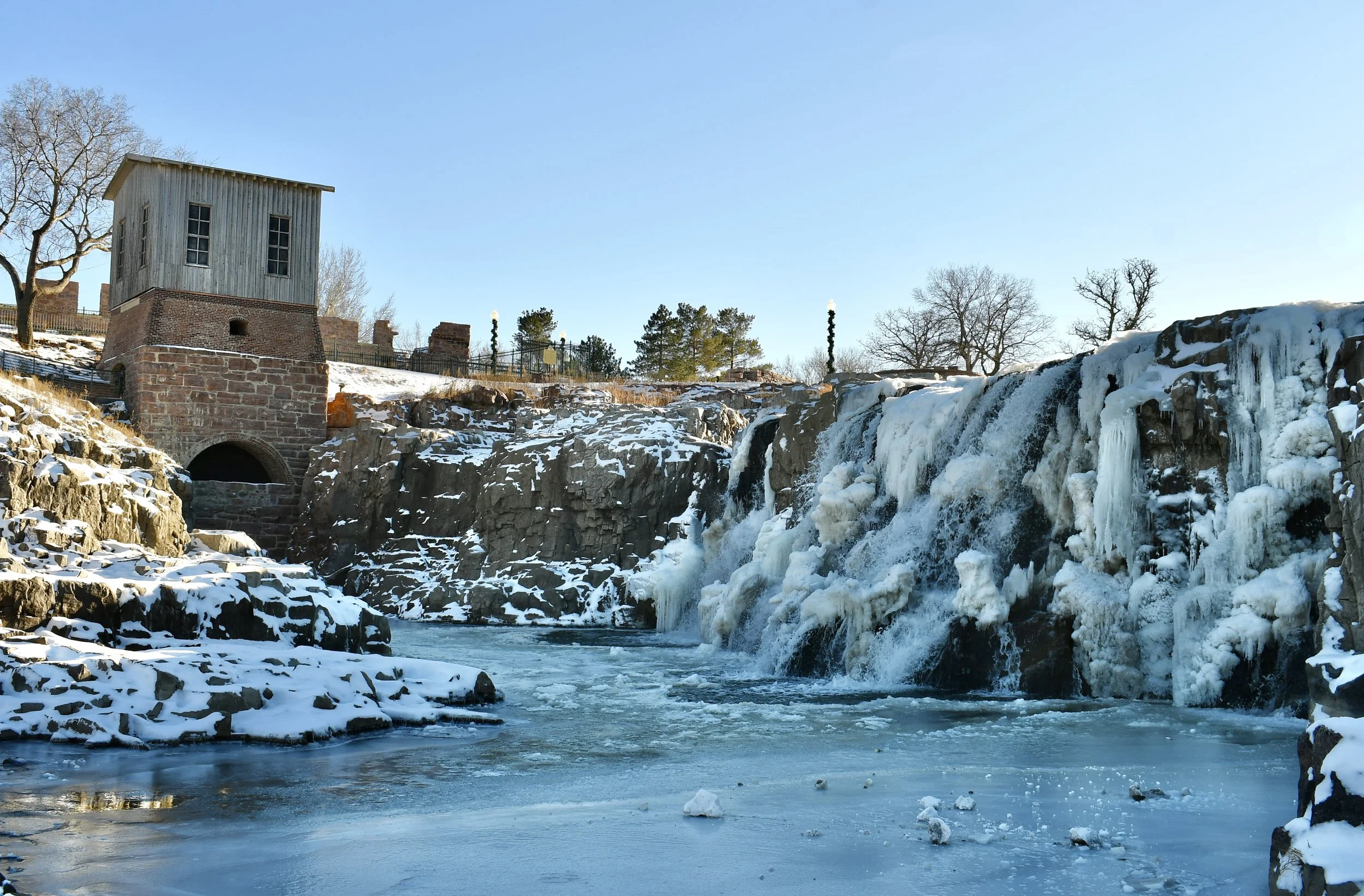
Farther downstream, north of the rail trestle, two overlooks on the west side of the falls were added, each offering spectacular views of crashing water. These viewing platforms were instantly inviting to park visitors as they walked from a nearby parking lot. Two new observation decks on the east side of the river also presented breathtaking and varied exposures to the falls. One platform, on a rocky bank below the Queen Bee Mill, replaced the park’s first viewing platform, a deck that had been assembled on top of the stone portion (the lower portion) of the Queen Bee’s turbine house after the structure’s upper section, made from wood, was removed. John Royster convinced city officials to eliminate the turbine house deck and return the small historic building to its original appearance. “The view from the park’s earliest overlook,” Royster recalled, “failed to capture the power and scale of the falls. It was too high and situated at an angle that made the falls look less significant.” Royster’s new platform was located closer to the river and delivered an intimate view facing tumbling, turbulent water. “I’m about five foot seven,” said Royster, “and when I stand on that platform, I am looking point blank at the precise place where the river drops over a long, steep precipice.” It is a startling sightline, a closeup confrontation with the gushing vein of a channel that abruptly bends straight down and sprays a mist over park visitors standing there. “This,” Katie Blesener declared, “is my favorite place in Falls Park.”
Viewers using the second new platform on the eastern side of the river found themselves positioned alongside and slightly above the falls, able to peer downward from that raised perspective at the back side of a cataract’s crest. “I selected the location of each viewing platform to provide the viewer with a different perspective of the falls, so they could watch water doing something they could not see elsewhere in the park,” explained Royster, pointing to flows stilled in a small, composed pool before they plummeted like an avalanche down a sheer vertical drop.
An observation tower was also proposed, and city officials suggested it be located alongside the most dramatic stretch of falls. John Royster preferred that the tower be connected to a new visitor center that would be situated farther away from the river, and his recommendation was approved. Mike Cooper described the process of deciding the height of the tower’s elevated viewing balcony. That verdict, explained Cooper, was not guided by engineering computations or architectural calculations. “We used a tree pruning boom to survey our options.”
At a predetermined time, the three men, Cooper, Royster and Steve Metli, as well as a city forester to chaperone the examination, arrived at the park to solve the dilemma. The day they chose was breezy, an intimidating factor considering the airborne instability of the lightweight lift. Each of the three men, accompanied by the forester, rode separately in the apparatus to judge various heights and perspectives. “John and I were nervous about rising too high in the strong gusts,” Cooper explained, “but Steve wanted to go higher and higher.” Finally, as the lift wobbled in the wind and reached its limit, Metli was satisfied. “He wanted that platform built as tall as the lift could go,” grinned Cooper. And it was: a hard-earned fifty feet.